This post was written by GIS Librarian, Larry Laliberte
Map staff conduct tours that bring the community into the library to interact with the collection. We also bring spatial materials from the collection out to interact with the community. The following sketches are three recent examples of maps as troubadours. Driven off campus, onto hastily arranged tables at Harry Ainlay school. Walked across campus, to be overlaid on the Indigenous Peoples Atlas of Canada floor map. Carried in an elevator, and appended upon institutional walls as an aside for an Indigenous Students Open House.
Folding
An invitation was extended in October of 2022 to present to an International Baccalaureate (IB) Theory of Knowledge course at Harry Ainlay high school. This provided an opportunity to draw from the cabinet drawers various maps and air photos and physically put them into the hands of students while viewing a virtual slide show.
Through the use of historical treaty maps and Native-Land.ca, students are situated on Treaty 6 territory, traditional lands of First Nations and Métis people. Using a three mile sectional map (Sheet No. 315) from 1920, students come to understand that their school occupies part of the north west edge of the former Papaschase reserve. From chronologically aligned topographic maps and air photos the school’s location is seen in a procession from a pipe yard to the beginning of its construction in 1965. The air photo also included a cultural feature that none of the students could identify. The “south-side” drive-in. With their 60% overlap, air photos viewed through a mirror stereoscope “geoscope” elicit pitch-perfect moments when viewers say aloud “I see it now” when the black and white building leaps into the third dimension.
Unfolding
In March 2023 Indigenous Initiatives Team and Campus Community & Recreation displayed the Peoples Atlas of Canada giant floor map in the Van Vliet Complex. Designed by the Royal Canadian Geographical Society, the vinyl floor map measures 8m x 11m, and displays Indigenous language groups, the locations of Indigenous communities, residential schools, and current and historical reserves, including Papaschase.1 To enhance the immersive experience of walking on a map, cartographic material from the collection was brought along. This allowed individuals to compare zoomed-in, larger scale views of an area with the smaller scale floor map.
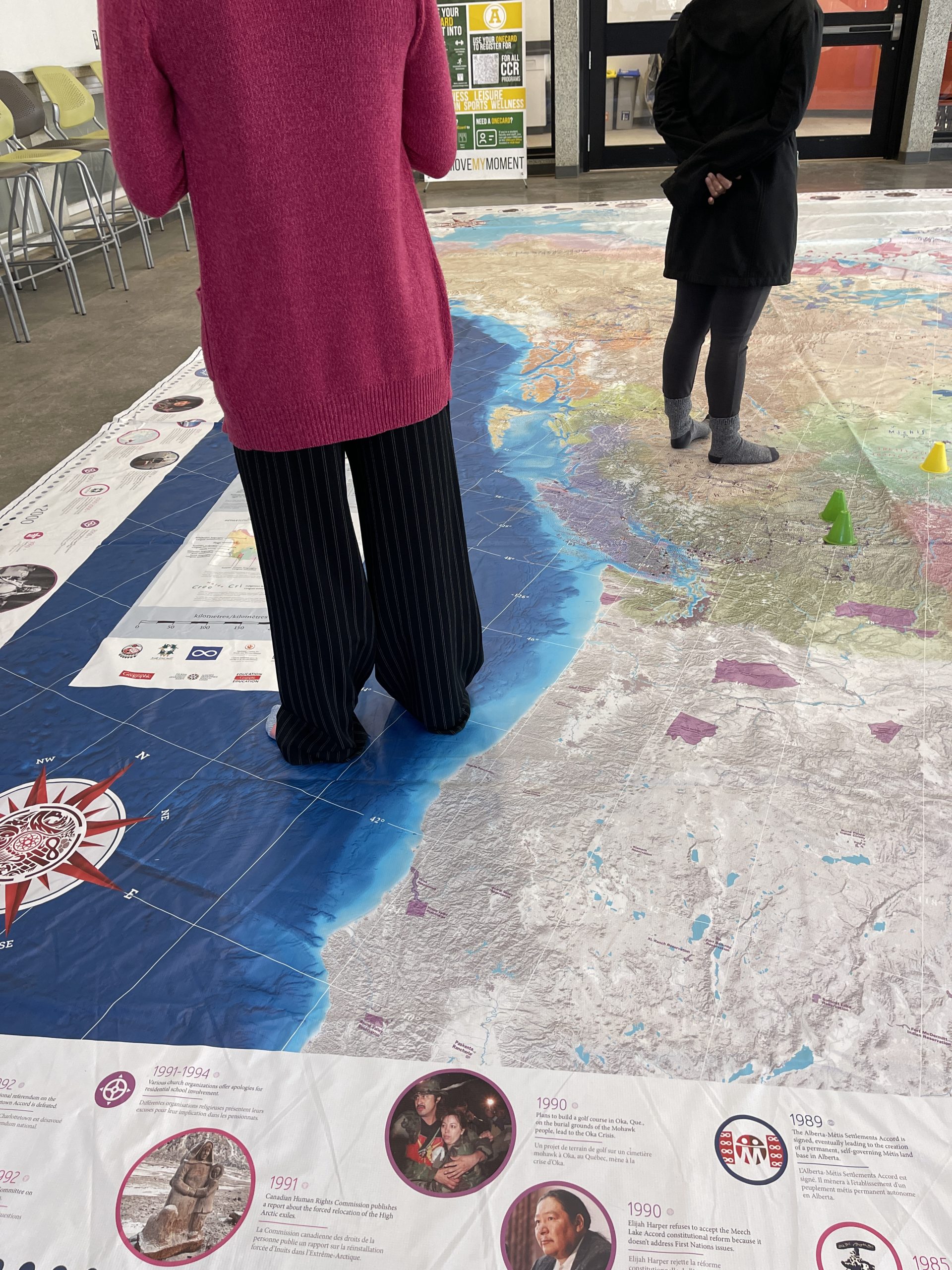
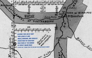
While walking across the floor map’s prairies, one is struck by the absence of township lines. Dense lines of dispossession, “a net to ensnare the land”2 found on published maps of the prairies beginning in the 1880s onward. To counter these Dominion Land Survey lines, J.S. Dennis’ Plan for the Survey of the Red River Plain, with the mark indicating where the survey party was stopped by Louis Riel, and his men, is combined with Marilyn Dumont’s poem October 1869: to smoke their pipes and sing their songs:
blocking their line of sight
their ledger of lines
angles, meridians, and parallels
corrections for curvature
iron stakes at the corners
of perfect square miles
Dumont, Marilyn. (2015). The pemmican eaters. ECW Press.
Refolding
In April the Indigenous Initiatives Team hosted an Indigenous Students Open House in Cameron library’s Fireside Lounge. As part of the event Indigenous maps from the collection were put on display. These included: Coming Home to Indigenous place names in Canada; Lake Eyre Basin Aboriginal Way : land, water & cultures; and the recently purchased First Nations Stampede a guide to First Nations history at the Calgary Stampede. This map not only serves as a historically important spatial document, it is also accompanied by phenomenal cataloguing work done by the Cataloguing Strategies unit.
During a break, discussions occurred related to adding more Indigenous maps to the collection. Examples included, the Ininew Achakos Masinikan a Cree star map – since ordered. Maps by Spirit Lake Dakota/Mohegan/Muscogee artist Marlena Myles, and how the library might purchase a reproduction of the artistic rendering of Papaschase superimposed on Edmonton found on the Tawatinâ LRT Bridge.
Folding, unfolding, and refolding. Maps allow us to “gaze upon interlocking systems of power, and open up spaces for restorative change.”4 As settler practitioners we need to continue to draw upon our professional areas of expertise, and accumulated fluency in institutional logics to dismantle “regimes of rhetoric and their exploitative material practices”.5
References
- Royal Canadian Geographical Society https://cangeoeducation.ca/en/maps/indigenous-peoples-atlas-of-canada/
- Heat Moon, W. Least. (1991). PrairyErth : (a deep map). Mariner Books.
- Fujikane, Candace. (2021). Mapping Abundance for a Planetary Future. Duke University Press.
- Ibid