news.library.ualberta.ca
  • BLOG HOME
  • About
    • Author Profiles
    • Five Things You Need to Know About the Library
    • Cinq choses à savoir sur la bibliothèque
  • Collections
  • Community
  • Wellness
  • Français
    • Cinq choses à savoir sur la bibliothèque
news.library.ualberta.ca
  • BLOG HOME
  • About
    • Author Profiles
    • Five Things You Need to Know About the Library
    • Cinq choses à savoir sur la bibliothèque
  • Collections
  • Community
  • Wellness
  • Français
    • Cinq choses à savoir sur la bibliothèque
Tag:

maps

    Map a-day-in May (a thirty-one cabinet display)

    by Guest Author July 7, 2025
    written by Guest Author

    This past May, Larry Laliberte, GIS/Maps Librarian, and Bonnie Gallinger Information Services & Maps Specialist curated a unique map exhibit on the 4th floor of Cameron Library; the exhibit was built day by day for 31 consecutive days in the month. Thank you to Larry and Bonnie for writing this guide to the exhibit. We invite you to take some time this summer to explore and engage with these fascinating items on display on the map cabinets. 

    There was a time. 

    A temporal splay, before we collectively entrusted our soles to the GPS embedded in our phones, that to traverse point-to-point between place-to-place, folk had to ever and anon ask for directions. Even more, they were oft-obliged to remember lengthy depictions that contained roundabouts, switchbacks, and landmark plot twists. 

    Consider what follows such a tale-o’-the-trail. So let’s attire in spatial troubadour, and dismiss those saturated satellites that Billy Bragg once wished upon.

    Navigating to Cameron Library 4th Floor

    Entering Cameron Library, and facing the Service desk you are pointed East. Keep moving, but don’t forget to give an acknowledging smile, to the individuals who, with composure and forbearance, engage with library patrons daily. Once you arrive at the East stairs, and elevator, the expedition gets vertical. Climbing over contours, and ascending heights of land you portage to the fourth floor.

    Navigate to the North West cabinet that faces South, the fluxatlas[:] awaits.

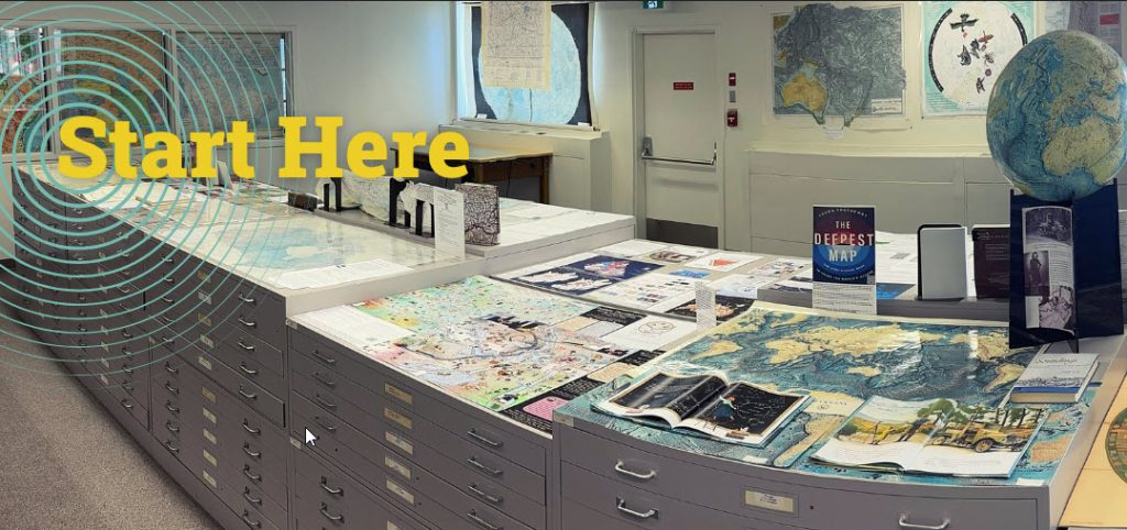
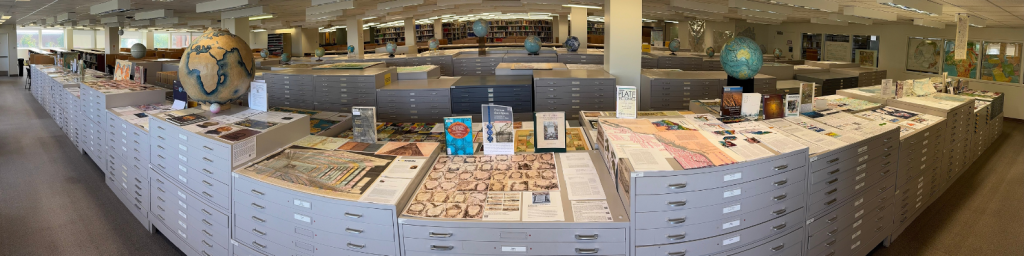
    As you enter the floor, perform a left shoulder check if you see a space entitled “Donor Wall” containing a 1921 map titled “The Dominion of Canada & Newfoundland. You have rhumblined a correct course and can now pivot to the right. Continue your journey to the North shore of the fourth floor where a wrack line of quarter sectioned map cabinets are arranged under a North West moon that filters natural light. Navigate to the North West cabinet that faces South, the fluxatlas[:] awaits.

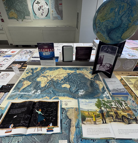
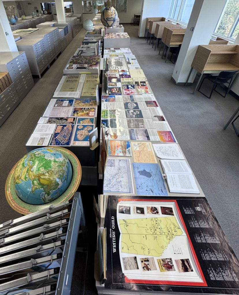
    Open the first drawer that surmounts Gibraltar, take a directional bookmark (or two), and, if at any time you have a comment, thought, or if inclined, a spatial poem, write it down while aligned with your bookmark to the North, South, East or West. Also, scoop up one of the “Meet the Map” index cards that provide useful prompts to situate, and better comprehend the maps you will encounter. By using “Meet the Map” you can shift from discovery and investigation to interrogation. In keeping with the floor’s official silent designation, in quiet contemplation absorb the spatial collage entitled “Map a-day-in May (a thirty-one cabinet display)”. Slow your pace, jettison the hectic, beguile a while amongst the tactile and visually absorb a wunderkammer of maps, images, articles, books, atlases and if seeking further information scan those utilitarian QR codes that tether you back to the virtual realm. Follow the map cabinets East. At the map cabinet terminus and just past the hanging 3-D plastic relief models perform a U-Turn, and then head Westward where Narnia awaits.

    • Were there maps that caught your eye, surprised you?
    • Maps and their stories that were uplifting and/or upsetting?
    • Were there cartographers, artists and researchers we missed?
    • If you were to curate a map cabinet top, what spatial display would you conjure?

    Share your answers to these questions and your feedback about this display with Larry Laliberte, GIS/Maps Librarian at data@ualberta.ca. 

    This content is licensed under a CC BY-NC-SA 4.0 Creative Commons licence.

    July 7, 2025 0 comment
    2 FacebookLinkedinRedditWhatsappEmail
  • Folding, Unfolding, Refolding Maps in the Community

    by Guest Author May 2, 2023
    by Guest Author May 2, 2023

    This post was written by GIS Librarian, Larry Laliberte Map staff conduct tours that bring the community into the library to interact with the collection. We also bring spatial materials from the collection out to interact with the community. The following sketches are three recent examples of maps as troubadours. Driven off campus, onto hastily arranged tables at Harry Ainlay school. Walked across campus, to be overlaid on the Indigenous Peoples Atlas of…

  • Touring Through an Open House: Navigating the William C. Wonders Map Collection’s Colonial Legacies

    by Guest Author April 27, 2023
    by Guest Author April 27, 2023

    This post was written by GIS Librarian, Larry Laliberte In March 2020, the University of Alberta William C. Wonders map collection sheltered in place as a global pandemic unfolded. It would be a year before staff could return in full, creating a disconnect from the physical space. During this absence, map staff began planning in-person map collection tours that would recalibrate the collection as evidence of extractive dispossession, rhumb the maps as…

  • Indigenous Peoples and National Parks Behind the scenes: A confluence of requests, resources and collaboration

    by Guest Author December 8, 2022
    by Guest Author December 8, 2022

    This post is written by Map Collection Staff, Larry Laliberte & Bonnie Gallinger. The Indigenous Peoples and Canada’s National Parks guide is a multidisciplinary literature review that introduces the historical and current relationship of Indigenous people and Canada’s National Parks. The creation of this guide is part of ongoing work in re-positioning the William C. Wonders (WCW) map collection. As one might expect, within such a large academic library the WCW map collection is…

  • Indigenous Peoples and National Parks Part 2: Countering the Celebration of Mapping

    by Guest Author December 1, 2022
    by Guest Author December 1, 2022

    This post is written by Map Collection Staff, Larry Laliberte & Bonnie Gallinger. The Indigenous Peoples and Canada’s National Parks guide is a multidisciplinary literature review that introduces the historical and current relationship of Indigenous people and Canada’s National Parks. The creation of this guide is part of ongoing work to re-positioning the William C. Wonders (WCW) map collection.  This guide is an example of the growing awareness that Indigenous peoples’ experience in the…

  • Indigenous Peoples and National Parks – Part 1

    by Guest Author November 24, 2022
    by Guest Author November 24, 2022

    This post is written by Map Collection Staff, Larry Laliberte & Bonnie Gallinger. The William C. Wonders (WCW) map collection is actively consulted throughout the year and includes a wide range of reference questions drawing upon various thematic sections of the collection. Reference questions are the primary drivers in the accumulation of tacit staff knowledge of numerous research areas thus deepening the reference experience for our researchers. The identification of relevant map…

  • Let us introduce you to… Kayla Lar-Son!

    by Eva Romanick April 16, 2020
    by Eva Romanick April 16, 2020

    Staff profiles tell the story of an organization. Here at the University of Alberta Library, this is ours… Meet Kayla Lar-Son!Kayla Lar-Son is an Indigenous Academic Resident in Digital Initiatives. She is also an outreach librarian for the Transition Year Program at the University. Originally, Kayla is from Tofield AB, and is a proud member of the Metis Nation. When she’s not at work she can be seen scooting around town in…

  • Collection Connection with Alex McPhee

    by Eva Romanick September 5, 2019
    by Eva Romanick September 5, 2019

    Students and staff use the library on the daily, in person and online. This is how… Alex McPhee is a fourth-year geophysics undergraduate and self-taught open GIS specialist. In his spare time, he’s been systematically visiting every county in Alberta. If you know anybody who has the security clearance to get visitors into Improvement District #349, he’d love to meet you! What is your “go to” resource for research in the UAlberta…

  • Real Life Special Collections – The William C. Wonders Map Collection

    by Sonya Leung August 7, 2019
    by Sonya Leung August 7, 2019

    ♫♪ “I’m the Map, I’m the Map, I’m the Map!” ♫♪ “Mommy, what is the Map do?” It was a rainy Sunday afternoon in Edmonton and at my three year old’s request we were watching Dora The Explorer. “Uh, a map tells you where to go.” I blurt out as I let the dog in from the back yard and try to catch her with a towel before she traced mud all…

Instagram Corner

No any image found. Please check it again or try with another instagram account.

Categories

  • Collections (242)
    • Borrowing (64)
    • Collection Connection (5)
    • Digital Collections (104)
    • Special Collections (7)
  • Community (435)
    • Awards (16)
    • Events (29)
    • Exhibits (16)
    • News (22)
    • Staff (66)
  • Digital Services (21)
  • Français (147)
  • Wellness (39)
    • Dogs in the Library (5)

BLOG ARCHIVES

About Me

  • Instagram
  • Youtube

@2020- University of Alberta Library
The University of Alberta is situated on traditional Treaty 6 territory and homeland of the Métis peoples. Amiskwaciwâskahikan / ᐊᒥᐢᑲᐧᒋᕀᐋᐧᐢᑲᐦᐃᑲᐣ / Edmonton


Back To Top